dredging identity
Year: 2010
Size: 30,000 ha
Type: research
Location: Lingang, Shanghai, China
Partner in charge: Nicola Saladino

Nowadays China is undergoing an unprecedented process of urbanization and millions of people move every year from the countryside to the more developed coastal regions. In order to release the pressure of such migration on the already saturated metropolitan areas, the central government has planned to create as many as twenty new cities every year. This drastic transformation of the territory offers a unique combination of problems and opportunities. Refusing a mediation with the forces that drive the urbanization would be quite a conservative and unproductive form of resistance. The capitalist logic of profit cannot be totally denied, but the social and environmental effects of the urban transformation should be put into the picture and evaluated as part of the overall balance. Through a systematic analysis of the costs of urbanization, this project aims to demonstrate that a design based on the specificity of the local morphology, the optimization of the natural systems and a resilient phasing strategy can be a viable economic investment while avoiding at the same time the total annihilation of the local identity, so often associated to globalized market-driven developments.
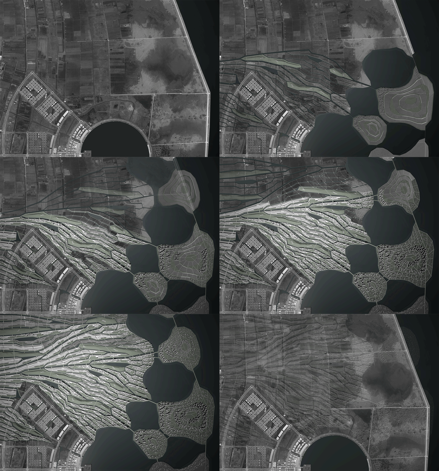
Lingang was planned as part of the 1966 plan for the regional expansion of Shanghai, on an area of reclaimed land on the head of the Yangtze River Delta, with the goal of housing up to 800,000 inhabitants by 2020. The original masterplan, organized in a very rigid geometrical fashion, does not take into account two important elements of the site: the existence of a consolidated pattern of linear villages along agricultural canals - which are very valuable not only for their architectural and environmental beauty, but also for their strong social identity - and the presence of the sea, with its ecology based on tidal dynamics. The creation of big mono-functional blocks and a low-density urban fabric produce high costs of urbanization and force the full implementation of the infrastructure at first, making the project functionally and economically inefficient. Furthermore, the newly reclaimed area lacks any topographic differentiation that could help its drainage and dangerously relies only on underground piping to expel the water that comes from the canals, creating potential problems of stormwater flooding during the wet season.
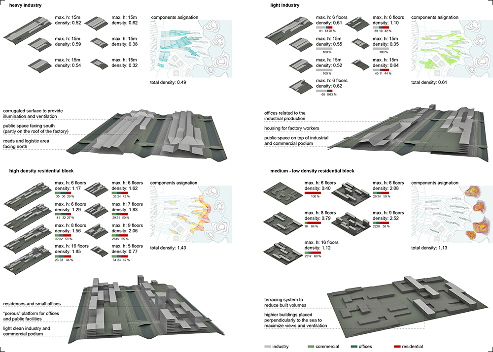
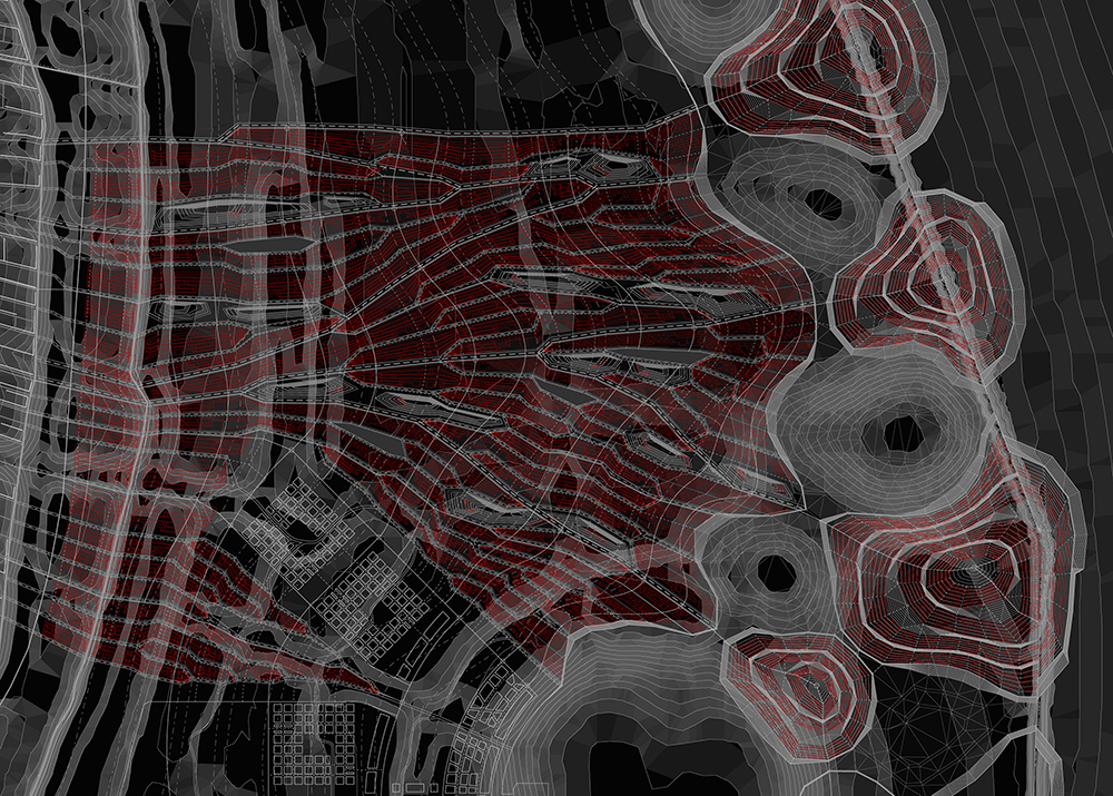
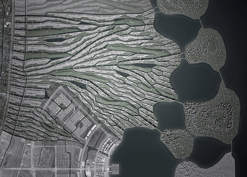
By reconsidering all the economic and ecological variables of the original masterplan, our design aims to create a more dynamic system based on a new coastline that reconciles the natural ecologies with the new urban activities and the creation of multifunctional clusters that can more efficiently adjust to the future changes in the growth of the city. On the one hand, a higher density scheme meets the goals of the original masterplan while allowing the preservation of the existing linear villages, on the other hand, the solution to the insufficient draining capacity of the terrain gives the opportunity to create a new network of canals and water bodies that organize and structure the urban fabric, becoming a crucial element of the public space. Finally, the new design maximizes the coastline and creates a multifunctional water interface, generating a higher land value that can at least partially compensate the costs of the dredging and earthwork needed, making the project economically sound.
中国正经历前所未有的城市化进程,每年都有数以万计的城郊居民涌入更为发达的沿海地区。中央政府已计划年均增建二十余新城以缓解这股移民热潮给城市发展带来的压力。大踏步城市化带来翻天覆地的变化,既是挑战,也是机遇。一方面,我们不可能为保持传统的价值而拒绝城市化的进程,不可能完全与资本的逻辑背道而驰;另一方面,我们要认真而客观的考虑城市化在环境和社会变化中的代价,这些都必须要被纳入城市设计决策的方程式中来权衡得失。通过对城市化成本系统性的分析,这个设计方案旨在探索一种尊重当地原有自然环境和地貌、以生态系统的优化为重要原则、分期化的、弹性设计的策略,同时兼顾经济可行性,试图避免全球化市场驱动发展所带来的地方性丧失。
临港是中国“十一五”规划中“1966”大上海发展战略的一部分,位于长江三角洲入海口的农垦区;2020年将有80万常住人口。在最初的规划方案中,乡村的原始风貌被完全忽视 ------ 当地建筑和自然风貌消失殆尽,原先依运河而建的线性村庄的独特肌理彻底丧失,取而代之的是单一功能的巨大分区和高度几何化的千篇一律的空间格局。单一区划和低密肌理严重增加了单位面积的城市化成本。机械刻板的几何化设计缺乏灵活性,城市在全部建成之前丝毫无法运转,基础设施则被迫要在开发起初全部建成。不仅如此,在环境方面,围海造田会极大影响到当地的水文系统,盐沼地的生态环境被破坏,排水受阻,也预埋了潮汛期爆发洪水的隐患。
该项目反思原有总规的薄弱之处,试图提出一个更加灵活开放的城市物质空间系统:展开一个全新的海岸线设计,同时改善滨海生态系统的状况,并提供更多亲水城市空间;试行一个多中心城市的策略,使整个城市能够面临未来变化而自我调整,灵活多变。此外,方案中提出的高密度的城市建设将有利于高效利用土地,以此来保留更多原有村庄形态;同时,在解决城市排水问题时也为建设新的城市水系带来了契机,这个网络化的运河系统将造就全新城市肌理,成为建构城市公共空间的重要因素。新的方案不仅最大程度地利用了自然海岸线,创造了多种亲水的城市界面和功能空间,其带来的地价提升更可补偿建设排水系统等土方工程的经济投入,使整个方案更具经济可行性。


