vertical territories
Year: 2010
Size: 20 ha
Type: research
Location: S Weymouth, Massachusetts, USA
Partner in charge: Chen Chen
External collaborators: E. Scott Mitchell, Amy Whitesides

South Weymouth Naval Air Station is an abandoned military base with a long history of aviation-related activities. The site is characterized by consistent winds and still presents the high water table that used to make it a vast marshland. It is also home to a number of rare and endangered bird species that inhabit grassland and wetland ecosystems, which have been in decline in Massachusetts over the past 100 years. The region suffers from regular flooding events while ironically it has constant problems of drinking-water shortage due to recent contamination and improper management.
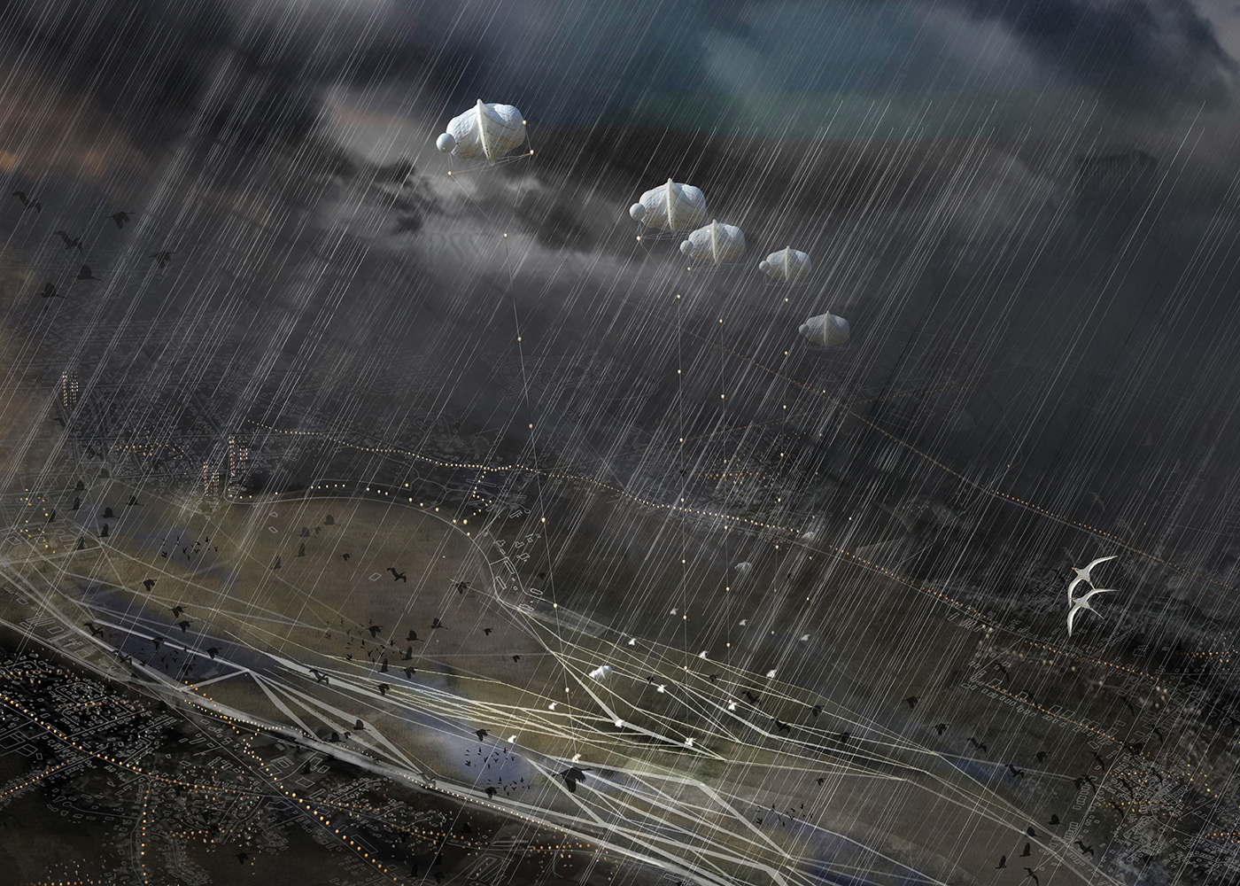
This project works on several levels at once to take advantage of the local natural resources of the site and regenerate its deteriorated hydrology and related ecosystems. Through the concept of "vertical territories" our design focuses on different layers of energy production, habitat preservation, water management and public recreation. On the top level, the wind facilitates the production of electrical power, thus, in resonance with the local past, we propose a new paradigm of aerial usage, introducing emergent high-altitude (600m) wind-power generators that operate for a fraction of the cost of traditional wind turbines and do not interfere with the routes of the migrating birds. On the ground, the demolition of impervious surfaces and the creation of infiltration ponds increase the water table; at the same time, the new wetlands act as a buffer zone to control flooding and work as a stormwater collection system to provide freshwater for the region. Finally, the creation of the new water system and mixed grasslands help regenerate the avian habitats.
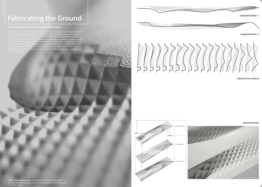
The wetlands are designed with differing permeability and smoothness based on their relationship to the aquifer and existing contamination, the cleanliness of the water they collect and some specific functional requirements. Several topographic changes are implemented in order to achieve the desired hydrologic conditions, though the cut and fill operations are balanced on site in order to minimize the costs. The existing ground conditions inform the size, organization and location of the stormwater wetlands and infiltration ponds. The structure of the new park is formed by an elastic network of “flow lines” parallel to the streams that are stretched and divided as needed to negotiate requirements such as pedestrian accessibility, different degrees of protection and optimal habitat sizes. The circulation system promotes public activities and connects the surrounding towns, improving the local connectivity.
This project shows that the multi-layered approach allows for high functional density without compromising the expansive open quality of the ground. Thus a once gated "backyard" of towns in economic decline becomes a generator of vital resources.
“纵向领域”是对位于波士顿南边已废弃的South Weymouth海军机场(以下简称SW机场)重新开发利用的空间策略。SW机场曾是一个长期进行航空业相关活动的军事基地,现已废弃。该地段处于一个高空风力强劲而稳定的地区,并且地下水位很高,机场在建设前是一片广袤的沼泽。这里的大片草地和湿地还是多种濒危动物的栖息地。SW机场所处的区域常年饱受洪涝灾害的威胁,而讽刺的是,不当的水资源管理和近年来的水污染造成附近居民饮用水短缺。
方案在多个层次,利用当地自然资源,更新恶化水质及相关生态系统。提出“纵向领域分层”的空间策略,突破一般的城市规划设计仅只关注地面设计的观念,同时考虑地下、地表、低空和高空各层空间,关注于各层空间的能源生产、栖息地保护、水管理和公众游憩。利用不同高度的空间处理不同需求:高空捕捉风能,地面改善公共开放空间和野生动物保护,并同地下含水层共同完成雨水收集管理。在高空,作为对本地历史的回应,我们提出了高空应用的一种新范型,引入高空风力发电技术(FEG)。这一创新的再生能源技术如今被认为比传统的地面风车技术发电具有更大的优势------更加经济、生态,成本仅为传统风力涡轮机的一小部分,,且不会对迁徙鸟类的飞行安全带来威胁。在地面,我们拆除大量不可渗透层,营造渗透池以提升地下水位。新的湿地系统作为控制雨洪的缓冲地带,同时充当为区域提供淡水的雨水收集系统,将洪水与水资源短缺问题综合解决,使洪水季节过剩的雨水降低流速并将其收集,经过湿地的净化导向地下含水层,作为旱季用水的储备。新的水系统和草地植被还将有助于重建鸟类栖息地。
不同的湿地“细胞”因在雨水处理的不同环节中具有不同的功能需求(如沉淀,清洁和减速水流)而具有不同的底部土壤渗透性、地形平滑度。其与地段中现存的被污染土壤区域和含水层的位置关系也是影响其形态、性质的决定性因素。为达成理想的水文条件,我们进行了一些地形改造;场地的挖方和填方操作量基本持平,尽量降低成本。雨洪湿地与渗透池的大小、位置和结构关系基于现状地面条件确定。综合考量行人可达性、不同保护等级的评估和最佳栖息地大小等需求要素,组织了弹性的流线系统。成为公共开放空间的湿地公园,最大程度地提供公众可达性以及对多种城市室外活动的容纳能力,成为新的社区公共空间。湿地公园内部的路径是经过对当地街道状况的仔细研究后提出的,充分地与邻里街道相衔接,激活三个相邻城镇的交通联接。
空间的分层使有限的空间具备了更高密度的利用价值和更多样的功能性,利用独特的组合与共存,将原本看似无关的空间创造出新的空间体验,却无须使原有空旷广阔的土地过分拥挤。这一公共空间将首次打破三个相邻城镇之间存在了70年之久的隔阂,将这一几乎被遗忘的边缘空间重新转化为市民集聚和活动的中心。


