shenzhou peninsula
Year: 2017
Size: 60 ha
Type: masterplan
Status: competition
Location: Wanning, Hainan, China
Client: Guoan Citic Group
Partners in charge:Chen Chen, Nicola Saladino, Federico Ruberto
Design team: Shoutuo Lyu, Kangyi Shen, Yuzhou Peng, Zhe Wang, Yaxin Zhao, Andrew Bryant, Chuhan Zhang, Meikang Li

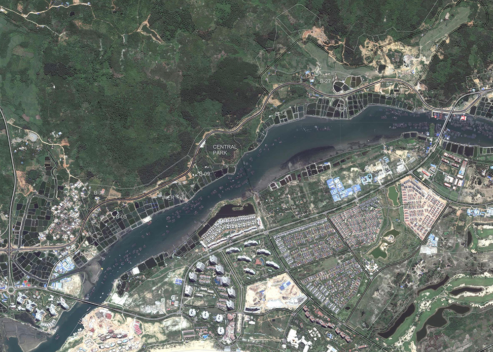
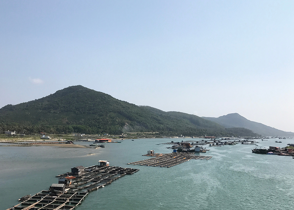
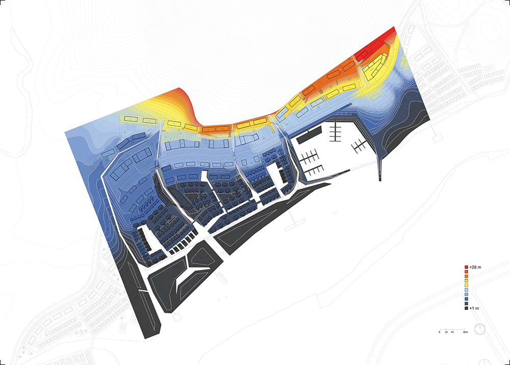
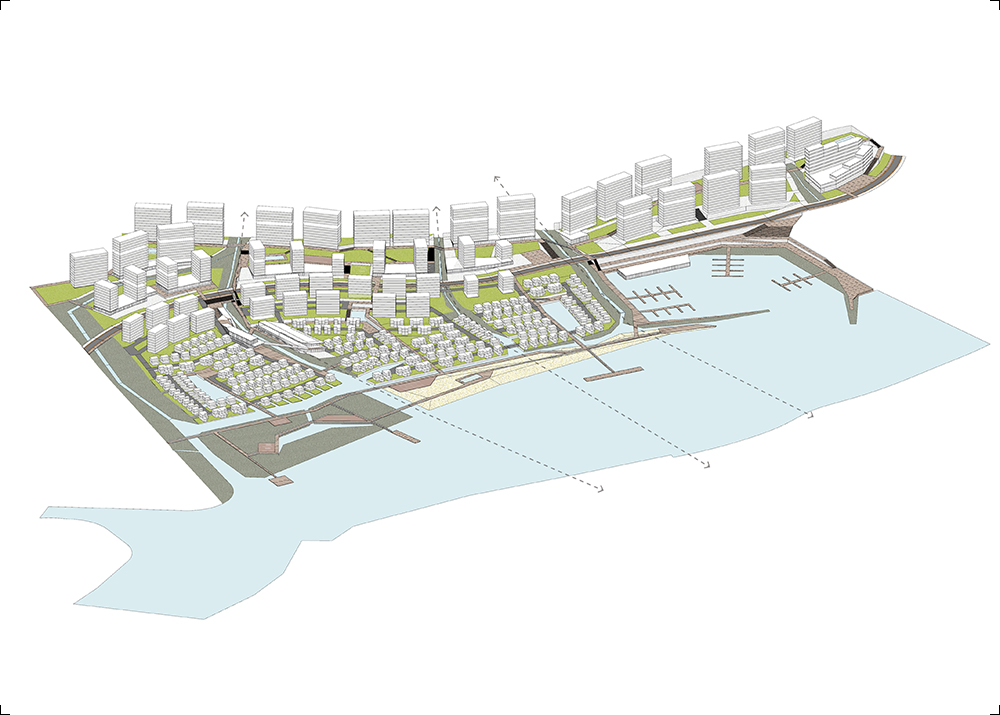
The project locates in Hainan Shenzhou Peninsula, with a typical tropical climate. Its 8 plots extended along the interface between the mountain and the sea, forming a linear belt with extremely rich landscape and topographical conditions. Drastic elevation changes (39m total in the whole site) together with the presence of high-rise housing towers generate very different viewing conditions towards the sea and thus highly varied land values. How to manipulate the building masses to maximize the overall views towards the sea was one of the main challenges of this project.
Based on a careful reading of the site morphology as well as the ecological conditions of its larger territory, our scheme proposes a series of ecological strategies that take advantage of the development as an opportunity to enhance local ecosystems. For example, we aimed at recovering the mangrove habitat, which has been heavily damaged in the last decades, as a crucial resource for biodiversity. Planting mangroves is also a natural mechanism for flood mitigation that allows a more intimate and shallow seashore rather than the construction of concrete seawalls. Also, a multi-layered storm water management system is designed as part of the green infrastructure, making it a low-impact development which will be an important demonstration of the application of the spongy city principle to a dense housing neighborhood.
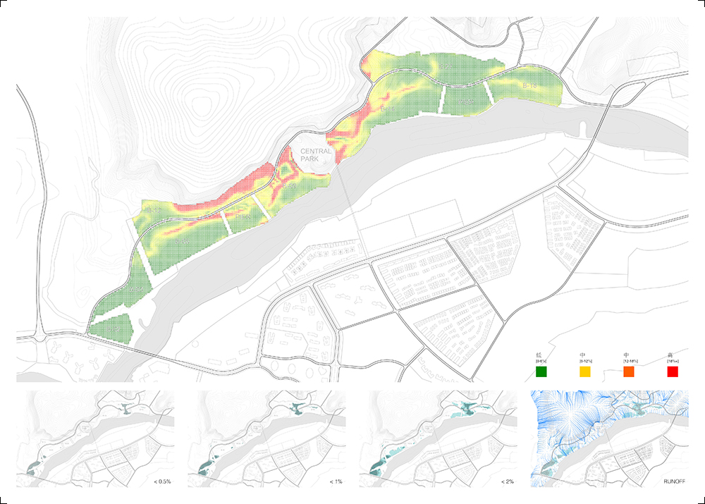
A number of green corridors are proposed according to the analysis of the surface runoff, forming an efficient water discharge framework with the minimum earthwork needed. Parametric tools are applied at this step to spot out areas with the most concentrated runoff, the least sea views, the best original land covers as well as the poorest storm water drainage. These series of locations are the best places to locate the green corridors, whose sizes are determined according to the amount of runoff naturally converging due to the geometric configuration of the topography. The general site mesh is structured by a series of control curves as road axes coming from simplified contours (parallel to the seashore) and the green corridors as main pedestrian axes connecting the mountain to the sea (perpendicular to the seashore). The green corridors become navigation channels that allow sailing boats to explore deeper inland, extending the active length of the shoreline. The wetlands located along the green corridors are storm water treatment devices that clean the water runoff in the process of draining towards the estuary, improving over time the water quality of the lagoon.
项目位于海南神州半岛,当地是典型的热带气候,炎热多雨。八个地块沿山海交界线展开,构成一个狭长带状的规划整体,形成了水陆、高低丰富变换的景观格局。地段内原始地形的高差(39米)和相邻板块高层住宅对观海视线的遮挡,使得地段内不同区域朝向开放海域的视野价值差异巨大。对于地段内建筑看向内外双海的景观视线的精确控制是项目的挑战之一。
基于严谨的地形地貌分析和对当地生态环境现状的调研,我们的规划方案提出了最适合该地段的一系列生态规划策略。我们希望借项目开发的契机,围绕老爷海国家海洋公园开展一系列生态修复,恢复遭破坏的红树林生态系统,建设低影响开发模型下的海绵城市理念新住宅区。
我们通过基于原始地形的参数化分析,创造一系列陆水交织的绿色廊道,他们从山到海,形成一个完整立体的自然生态廊道系统。我们尽量使用海景价值低,本身植被良好,又存在内涝隐患的区域作为重要的景观区域。地表径流在原地形上的精确模拟生成汇水线,作为排洪绿廊的位置和尺寸依据。平行于海岸线的等高线被简化为台地控制线,并作为小区内部路网的控制线,另一方向垂直于海岸线的绿廊系统同时作为主要步行系统,两个方面的控制线形成初始的总图网络。沿海岸线的打造综合考虑了地表径流和河床等高线,引水开渠的策略不仅提供一些深入陆地的游艇航线,也保证汇入老爷海的雨水在经过住宅区的过程中已得到足够的过滤、滞留和净化,在未来逐步提升老爷海水质。
